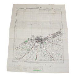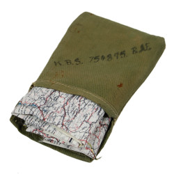


Map, Escape, Silk, MI 9, CYRENAICA, North Africa, K1/K2
Rare genuine WWII British silk escape map, Cyrenaica, printed on both sides.
Scale: 1:1,657,000.
This is one of the earliest series of silk or rayon escape maps produced by Bartholomew of Edinburgh on behalf of the MI 9, heat-treated to prevent the cloth from unravelling, and intended for being issued to RAF and USAAF aicrews flying of enemy-occupied territories.
The first side covers the coastline of Cyrenaica -- that is, eastern Libya -- and the Nile Delta, Egypt, from Benghazi to Port Said, as well as the island of Crete; the second side covers a wider part of North Africa, encompassing eastern Algeria, Tunisia, Libya, along with the northern regions of Niger and Chad.
Excellent overall condition -- no snag, no tear.
Dimensions: 18.90in x 21.65in.