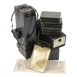
Rare genuine WWII British silk escape map, I.S.9.(X), dated December 31, 1942.
Scale: 1:2,000,000.
This is one of the earliest series of silk or rayon escape maps produced by Bartholomew of Edinburgh on behalf of the MI 9, heat-treated to prevent the cloth from unravelling, and intended for being issued to RAF and USAAF aicrews flying of enemy-occupied Europe.
Printed on a single side, this version covers mainland France (Corsica is not included), the Channel Islands, Belgium, Luxembourg, the southern part of the Netherlands, along with the border regions of Germany, Switzerland, Italy and Spain.
The demarcation line between the German-occupied zone and the so-called 'free' zone, which was de facto invaded on November 11, 1942, are clearly visible, as well as the main roads, railroad tracks, and waterways -- all invaluable information for any fugitive trying to make it back to Britain.
Good overall condition despite a single hole in the lower-right corner.
You might also like
Rare genuine WWII British silk escape map, I.S.9.(X), dated December 31, 1942.
Scale: 1:2,000,000.
This is one of the earliest series of silk or rayon escape maps produced by Bartholomew of Edinburgh on behalf of the MI 9, heat-treated to prevent the cloth from unravelling, and intended for being issued to RAF and USAAF aicrews flying of enemy-occupied Europe.
Printed on a single side, this version covers mainland France (Corsica is not included), the Channel Islands, Belgium, Luxembourg, the southern part of the Netherlands, along with the border regions of Germany, Switzerland, Italy and Spain.
The demarcation line between the German-occupied zone and the so-called 'free' zone, which was de facto invaded on November 11, 1942, are clearly visible, as well as the main roads, railroad tracks, and waterways -- all invaluable information for any fugitive trying to make it back to Britain.
Good overall condition despite a single hole in the lower-right corner.