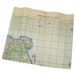

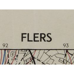

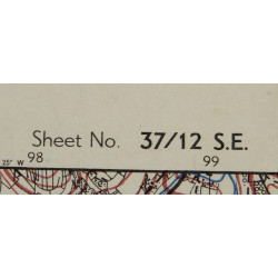

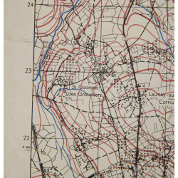


Genuine WWII Allied map, Flers, Edition of Feb. 1944, Sheet No. 37/12 S.E., scale 1:25,000. This map covers a large perimeter located north-east of the town of Flers, Orne department, Normandy, France.
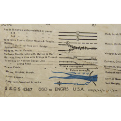
Edited by the General Staff-Geographical Section of the British War Office and reused by the US Army 660th Engineer Topographic Battalion.
Quite good overall condition. Dimensions: 20in x 26.4in.
You might also like
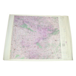
Genuine WWII Allied map, Flers, Edition of Feb. 1944, Sheet No. 37/12 S.E., scale 1:25,000. This map covers a large perimeter located north-east of the town of Flers, Orne department, Normandy, France.
Edited by the General Staff-Geographical Section of the British War Office and reused by the US Army 660th Engineer Topographic Battalion.
Quite good overall condition. Dimensions: 20in x 26.4in.