Map, Allied, SAINT-SAUVEUR-LE-VICOMTE, Normandy, 1943
search
Map, Allied, SAINT-SAUVEUR-LE-VICOMTE, Normandy, 1943

Map, Allied, SAINT-SAUVEUR-LE-VICOMTE, Normandy, 1943

€475.00 Tax included

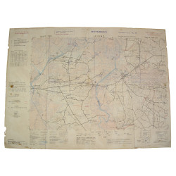
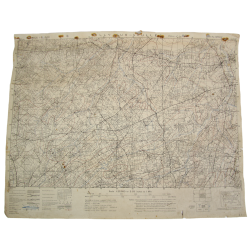
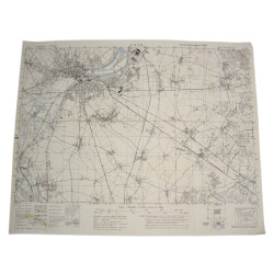
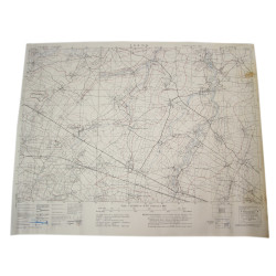
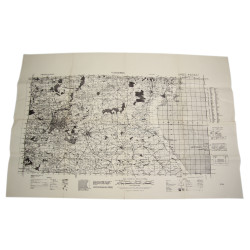
Rare genuine WWII Allied map, St. Sauveur, Edition of September 1943, Sheet 31/18 N.W., scale 1:25,000.

Edited by the General Staff-Geographical Section of the British War Office and reused by the US Army 660th Engineer Topographic Battalion, the present map covers a large perimeter around the town of Saint-Sauveur-le-Vicomte, Normandy, France, which was liberated on June 16, 1944 by various elements of the 82nd Airborne Division.

Very good overall condition.

Dimensions: 19.5in x 24.4in.

Product Details

IC1025