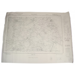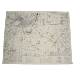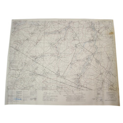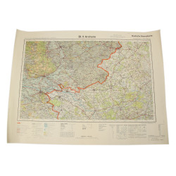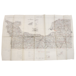


Map, Caen, Normandie, Wehrmacht, 1941, Landing beaches
€495.00
Tax included
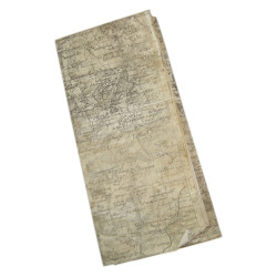
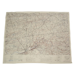
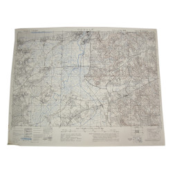
Rare genuine WWII German map, Caen, Sonderausgabe VII 1941.
Scale 1:80,000.
Edited by the Wehrmacht, this map actually covers a large part of the Calvados département, including the future British and Canadian amphibious landing sectors (Gold Beach, Juno Beach, Sword Beach) and the various Drop Zones and Landing Zones of the 6th British Airborne Division.
Quite good, used condition.
Dimensions: 25.20in x 38.40in.
Product Details
IC0426
You might also like